![]() ESRI is known for their GIS applications but at GDC they were showing off Cityengine, a blend of content creation and GIS. I you can imagine something between a full professional GIS application and a procedural content generator, you get the idea.
ESRI is known for their GIS applications but at GDC they were showing off Cityengine, a blend of content creation and GIS. I you can imagine something between a full professional GIS application and a procedural content generator, you get the idea.
It is one thing to use a program like ArcGIS to model an area down to the most specific detail you care about, but that is rather static. The real world is a useful thing to inhabit, but there are enough “what if” questions that can rise from GIS data that a program to answer them is in order. Much of this functionality is built into Cityengine.

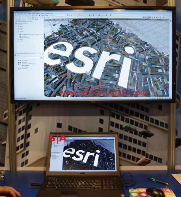
Real cities don’t have logo bearing thoroughfares
The idea is simple, either sketch out a city, set parameters and procedurally generate one, or import real GIS data. Then edit the result to your liking with content aware tools. This may sound like a normal CAD or modeling program but Cityengine steps out by incorporating rules about how a city works, or at least should work. If you want a road going through an area, in CAD/GIS you draw it then clean up all the resulting problems. This cleanup can be much more labor intensive than any other part, not to mention results that looks out of place unless the digital janitor is quite skilled.
Cityengine is much closer to intelligently flowing the city around your new thoroughfare than traditional placing and editing. It can regenerate the surroundings and incorporate clues from the existing structures, or you can take the manual approach. Since the basic city can be procedurally generated in the first place, a manual change is effectively another constraint that it can generate around.
The level of detail can be tweaked from full manual to fully generated, once again a time vs result tradeoff. As the name suggests, Cityengine builds cities. More interestingly, Cityengine can export to most hardcore GIS and CAD formats so you can take the result and slap it into most of the tools you use. You can essentially make what you want, then get it out in a sane way, a useful feature that many tools omit.
If you are gaming, it can make a GTANext city for you in short order which you only need to modify specific bits for game play reasons. Cityengine can do more than that though, if you are an architect and want to modify a real area, it can do things like estimate materials needed for that new structure, costs, time, and then visualize the end result. If you are a professional, it can make architectural level models for client presentations. It even works with third-party libraries to generate species correct plant formations for the areas in question. In short the ESRI heritage is fully baked in.

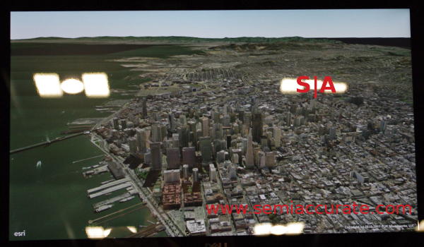
That is Los Francisco, right?
What started out as a professional tool has been modified to spit out cities quite amenable for gaming. It can make a simple 2D map or generate fully detailed 3D populated environments that look pretty good. In fact when SemiAccurate first glanced at the demo during GDC, we thought it was a real city. If Cityengine is as flexible and intelligent as it seems, it could be quite a boon for creating urban settings for games.S|A
Have you signed up for our newsletter yet?
Did you know that you can access all our past subscription-only articles with a simple Student Membership for 100 USD per year? If you want in-depth analysis and exclusive exclusives, we don’t make the news, we just report it so there is no guarantee when exclusives are added to the Professional level but that’s where you’ll find the deep dive analysis.
Charlie Demerjian
Latest posts by Charlie Demerjian (see all)
- Qualcomm Is Cheating On Their Snapdragon X Elite/Pro Benchmarks - Apr 24, 2024
- What is Qualcomm’s Purwa/X Pro SoC? - Apr 19, 2024
- Intel Announces their NXE: 5000 High NA EUV Tool - Apr 18, 2024
- AMD outs MI300 plans… sort of - Apr 11, 2024
- Qualcomm is planning a lot of Nuvia/X-Elite announcements - Mar 25, 2024